fiebichpvSeptember 14, 2015, 12:39am
180 Mile Cross-Country Flight
Getting Ready
As predicted by our local weatherman, Saturday, September 12th, dawned with the promise of a beautiful day; non-existent to light winds and temperatures reaching a high of 70 degrees. My anticipated flight to Emporia, Kansas (EMP) to attend the airport's annual fly-in called "Wings 'n Wheels" was a GO.
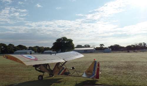
By 8:15 my AirBike was resting on the grass, fueled, pre-flighted, and ready for flight. After filing a flight plan with 1800 WX BRIEF, I taxied to runway 35 and took off from the dew laden grass. The wheels looked like a rotary lawn sprinkler flinging dew off their circumference as the takeoff speed increased.
Not in any hurry, I limited the RPM to 5800 which is my best fuel economy rate. This put my ground speed at a tad over 60 MPH. The flight is divided into three parts: 1) About 30 miles of farmland and small towns, 2) 45 miles of following I-35 through the Flint Hills, and 3) 15 miles of open range running over the Flint Hills.
Under Way
Having made this trip many times, I did not use my handheld GPS. The landmarks are by now well known and flying "IFR" over I-35 makes for easy navigating. The 90-mile flight would take about 1-1/2 hours.
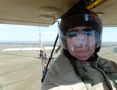
Ground temperature upon departure was 65 degrees, just warm enough for me to decide not to wear my leather flying jacket. Instead I wore a heavy flannel shirt and a light summer jacket, helmet and gloves. I should have gone with the leather jacket! At 1500 feet AGL the temperature was 60 degrees and dropping. 60 degrees isn't bad, but combined with the wind chill and enduring it for 90 minutes took its toll.
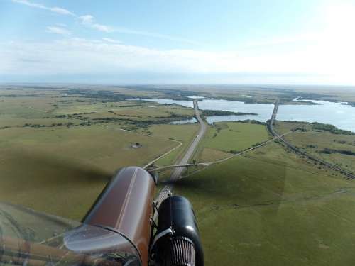
The transition between the first and second parts of the flight is marked by crossing the highway bridge on the north end of Lake El Dorado. It is here where “civilization” ends and the prairie isolation begins. Flying the bridge provides a safety net where as the lake and backwater on either side does not.
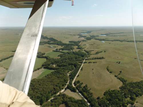
Flying over the Flint Hills barren grasslands illustrates its own beauty. The undulating hills, cottonwood trees along creek beds, grazing cattle herds, soft grassland, and remoteness, combine to create bucolic scenery.
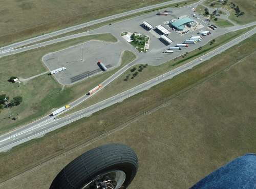
Flying the turnpike is done mostly for safety, the route is parallel to what I would fly anyway and it offers the comfort of a long "runway" to land on if I had to. Also, some of the bordering right-of-way roadside could serve as a landing strip. Flying about 10 miles east of the turnpike is a direct route but would leave me isolated if I had to make an emergency landing in the desolate Flint Hills grazing land. My safety quotient always overrules economy.
Last Leg
The twin tower landmark on I-35 marks the transition between the second and third portions of the flight. This is where I break from turnpike “IFR” flying and head out over the open range directly to the airport (EMP). During this leg an approaching storm I had been observing earlier was now even closer and of some concern. It was going to collide with me!
The storm was a localized cloud mass with cooler turbulent air and obvious rain shafts slanting towards the ground. Traveling in this new direction, the storm was closing in on me---fast. Judging by the speed of the advancing storm and my airspeed, I knew I would get wet unless I made a change. I could see the rain haze as it swept the ground only a few miles away.
There are no alternate airports where I was, my only real choice was to go faster and try to beat the storm. Advancing the throttle, the engine was soon at 6600 RPM and my ground speed was 71 MPH. That gave me a little edge on the advancing storm. My hope was to get past before it crossed my path. I almost made it.
Rain was soon splating on my windscreen and streaming up it in little rivers. I was getting wet on my left side. This lasted about two minutes then it stopped. I had gotten past the storm and Emporia Airport was now only one mile ahead. The dark clouds were behind me. Whew!
Arrival and Participation
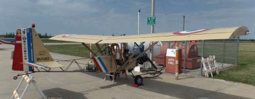
Emporia Airport has one concrete and two grass runways. I circled the field to check the windsock then landed on one of the grass runways. It felt good to be on the ground, I taxied past the row of hangars then was waved into a parking spot next to a Breezy built by Dave Blanton of Valley Center.
Warm greetings were expressed by several pilots and Don Tevis, the former Airport Manager now retired. It is nice to be recognized by so many other pilots, and nice for me to greet them as this is the only time we meet. While walking to the hangar for breakfast, I called Flight Service and closed out my flight plan. Then it was time to eat pancakes, sausage, and drink hot coffee. Boy, I sure needed the warmth of that coffee. At landing, my "biological stick-shaker" was beginning to take effect.
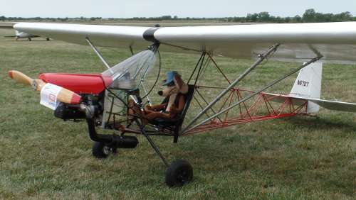
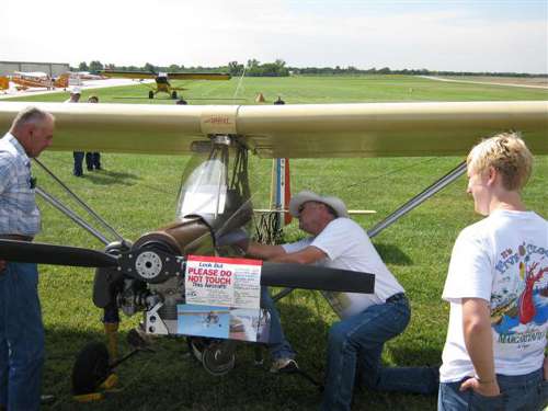
The local EAA chapter was giving Young Eagle flights. This is my opportunity to provide a hands-on "ground school" to those kids waiting for their rides. My AirBike is a magnet to kids and their parents. I encourage them to sit in the cockpit while giving instruction about the flight controls, engine and flight instruments. Anyone who is large enough to crawl into the seat is welcome; the youngest was a 1-year old who needed some help.
In addition to receiving instruction, this is a great Kodak moment for parents and grandparents. Often I can also encourage them to try the plane on for size. I think the greatest appeal is that my plane is very simple and looks kinda neat. I also enjoy talking to people and exposing them to a level of aviation far simpler than the complex full size "real" airplanes.
Finally at 1:30 I had to break things off and headed to the lunch line. Upon reaching it, the kitchen crew was almost finished cleaning up and had put things away. Showing a $5 bill was encouragement enough for them to make a pulled pork sandwich, put a handful of chips on my plate, and give me a large glass of lemonade. Their extra effort was appreciated.
Time to Fly Home
After another hour of visiting, I refueled my plane, filed a flight plan for Blue Sky Ranch & Aerodrome (35KS), and departed for home. I followed the same ground track as arriving and while over I-35 tried to match speeds with traffic.
After 20 miles of cutting corners of the turnpike route, I was able to finally pull abreast of two semi trucks that I was gaining on. A slight rear quartering wind helped keep my groundspeed between 65 and 70 MPH. While continually watching the trucks it soon became apparent that I was passing them! Whoo-ee! I finally beat the trucks!
My joy was short-lived. They had slowed to turn off into the Mattfield Green Rest Area! Well, anyway, I did get past them.
The sun shone brightly and the temperature did reach 70 degrees. That combination made for a bumpy return flight as I occasionally held onto the strut to brace myself against the turbulence. With its light wing loading, the AirBike is like a butterfly in a dust devil.
Journey’s End
Three miles out from my home airport, I made my silent radio call (I have no radio, for practice I just talk like I have one) and began my descent from 2000 feet AGL to 600 feet AGL. By 4:00 I was in the pattern at Blue Sky Ranch & Aerodrome near Haysville, Kansas. A crosswind of about 30 degrees made it reasonable for me to land on somewhat of a diagonal on the 200 foot wide runway.
Taxiing to the hangar apron and stopping, I let the engine idle for a few minutes to cool slowly, and then I shut her off. I sat in the cockpit a few more minutes to extend the trip's enjoyment, knowing that once I exit, the trip is over. I had logged 3.1 hours of time on the Hobbs meter. A call to Flight Service closed out my flight plan.
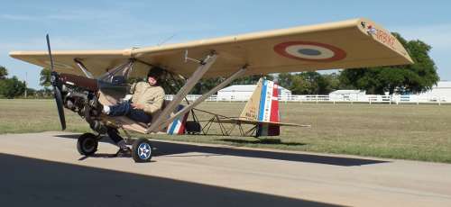
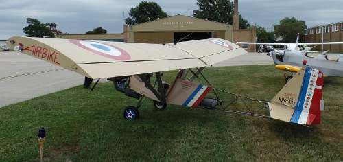
I can't help but marvel at what a wonderful little airplane the AirBike is. It fits my mission requirement precisely, is fun to fly and economical to operate. Since building it in 1998 it has continually opened up an entirely new world of activity for me. What fantastic experience aviation is. I still fly for fun and enjoy sharing the experience with others.
Paul D. Fiebich
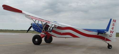
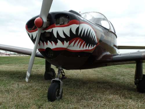
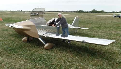
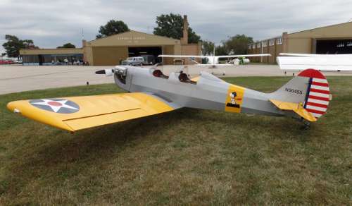
More photos on the next panel.
Getting Ready
As predicted by our local weatherman, Saturday, September 12th, dawned with the promise of a beautiful day; non-existent to light winds and temperatures reaching a high of 70 degrees. My anticipated flight to Emporia, Kansas (EMP) to attend the airport's annual fly-in called "Wings 'n Wheels" was a GO.
By 8:15 my AirBike was resting on the grass, fueled, pre-flighted, and ready for flight. After filing a flight plan with 1800 WX BRIEF, I taxied to runway 35 and took off from the dew laden grass. The wheels looked like a rotary lawn sprinkler flinging dew off their circumference as the takeoff speed increased.
Not in any hurry, I limited the RPM to 5800 which is my best fuel economy rate. This put my ground speed at a tad over 60 MPH. The flight is divided into three parts: 1) About 30 miles of farmland and small towns, 2) 45 miles of following I-35 through the Flint Hills, and 3) 15 miles of open range running over the Flint Hills.
Under Way
Having made this trip many times, I did not use my handheld GPS. The landmarks are by now well known and flying "IFR" over I-35 makes for easy navigating. The 90-mile flight would take about 1-1/2 hours.
Ground temperature upon departure was 65 degrees, just warm enough for me to decide not to wear my leather flying jacket. Instead I wore a heavy flannel shirt and a light summer jacket, helmet and gloves. I should have gone with the leather jacket! At 1500 feet AGL the temperature was 60 degrees and dropping. 60 degrees isn't bad, but combined with the wind chill and enduring it for 90 minutes took its toll.
The transition between the first and second parts of the flight is marked by crossing the highway bridge on the north end of Lake El Dorado. It is here where “civilization” ends and the prairie isolation begins. Flying the bridge provides a safety net where as the lake and backwater on either side does not.
Flying over the Flint Hills barren grasslands illustrates its own beauty. The undulating hills, cottonwood trees along creek beds, grazing cattle herds, soft grassland, and remoteness, combine to create bucolic scenery.
Flying the turnpike is done mostly for safety, the route is parallel to what I would fly anyway and it offers the comfort of a long "runway" to land on if I had to. Also, some of the bordering right-of-way roadside could serve as a landing strip. Flying about 10 miles east of the turnpike is a direct route but would leave me isolated if I had to make an emergency landing in the desolate Flint Hills grazing land. My safety quotient always overrules economy.
Last Leg
The twin tower landmark on I-35 marks the transition between the second and third portions of the flight. This is where I break from turnpike “IFR” flying and head out over the open range directly to the airport (EMP). During this leg an approaching storm I had been observing earlier was now even closer and of some concern. It was going to collide with me!
The storm was a localized cloud mass with cooler turbulent air and obvious rain shafts slanting towards the ground. Traveling in this new direction, the storm was closing in on me---fast. Judging by the speed of the advancing storm and my airspeed, I knew I would get wet unless I made a change. I could see the rain haze as it swept the ground only a few miles away.
There are no alternate airports where I was, my only real choice was to go faster and try to beat the storm. Advancing the throttle, the engine was soon at 6600 RPM and my ground speed was 71 MPH. That gave me a little edge on the advancing storm. My hope was to get past before it crossed my path. I almost made it.
Rain was soon splating on my windscreen and streaming up it in little rivers. I was getting wet on my left side. This lasted about two minutes then it stopped. I had gotten past the storm and Emporia Airport was now only one mile ahead. The dark clouds were behind me. Whew!
Arrival and Participation
Emporia Airport has one concrete and two grass runways. I circled the field to check the windsock then landed on one of the grass runways. It felt good to be on the ground, I taxied past the row of hangars then was waved into a parking spot next to a Breezy built by Dave Blanton of Valley Center.
Warm greetings were expressed by several pilots and Don Tevis, the former Airport Manager now retired. It is nice to be recognized by so many other pilots, and nice for me to greet them as this is the only time we meet. While walking to the hangar for breakfast, I called Flight Service and closed out my flight plan. Then it was time to eat pancakes, sausage, and drink hot coffee. Boy, I sure needed the warmth of that coffee. At landing, my "biological stick-shaker" was beginning to take effect.
The local EAA chapter was giving Young Eagle flights. This is my opportunity to provide a hands-on "ground school" to those kids waiting for their rides. My AirBike is a magnet to kids and their parents. I encourage them to sit in the cockpit while giving instruction about the flight controls, engine and flight instruments. Anyone who is large enough to crawl into the seat is welcome; the youngest was a 1-year old who needed some help.
In addition to receiving instruction, this is a great Kodak moment for parents and grandparents. Often I can also encourage them to try the plane on for size. I think the greatest appeal is that my plane is very simple and looks kinda neat. I also enjoy talking to people and exposing them to a level of aviation far simpler than the complex full size "real" airplanes.
Finally at 1:30 I had to break things off and headed to the lunch line. Upon reaching it, the kitchen crew was almost finished cleaning up and had put things away. Showing a $5 bill was encouragement enough for them to make a pulled pork sandwich, put a handful of chips on my plate, and give me a large glass of lemonade. Their extra effort was appreciated.
Time to Fly Home
After another hour of visiting, I refueled my plane, filed a flight plan for Blue Sky Ranch & Aerodrome (35KS), and departed for home. I followed the same ground track as arriving and while over I-35 tried to match speeds with traffic.
After 20 miles of cutting corners of the turnpike route, I was able to finally pull abreast of two semi trucks that I was gaining on. A slight rear quartering wind helped keep my groundspeed between 65 and 70 MPH. While continually watching the trucks it soon became apparent that I was passing them! Whoo-ee! I finally beat the trucks!
My joy was short-lived. They had slowed to turn off into the Mattfield Green Rest Area! Well, anyway, I did get past them.
The sun shone brightly and the temperature did reach 70 degrees. That combination made for a bumpy return flight as I occasionally held onto the strut to brace myself against the turbulence. With its light wing loading, the AirBike is like a butterfly in a dust devil.
Journey’s End
Three miles out from my home airport, I made my silent radio call (I have no radio, for practice I just talk like I have one) and began my descent from 2000 feet AGL to 600 feet AGL. By 4:00 I was in the pattern at Blue Sky Ranch & Aerodrome near Haysville, Kansas. A crosswind of about 30 degrees made it reasonable for me to land on somewhat of a diagonal on the 200 foot wide runway.
Taxiing to the hangar apron and stopping, I let the engine idle for a few minutes to cool slowly, and then I shut her off. I sat in the cockpit a few more minutes to extend the trip's enjoyment, knowing that once I exit, the trip is over. I had logged 3.1 hours of time on the Hobbs meter. A call to Flight Service closed out my flight plan.
I can't help but marvel at what a wonderful little airplane the AirBike is. It fits my mission requirement precisely, is fun to fly and economical to operate. Since building it in 1998 it has continually opened up an entirely new world of activity for me. What fantastic experience aviation is. I still fly for fun and enjoy sharing the experience with others.
Paul D. Fiebich
More photos on the next panel.